Radar

Sensa

Radar

A location-aware amenity finder for life on the road. Fuel, toilets, parking, vet, pub, wherever you are.

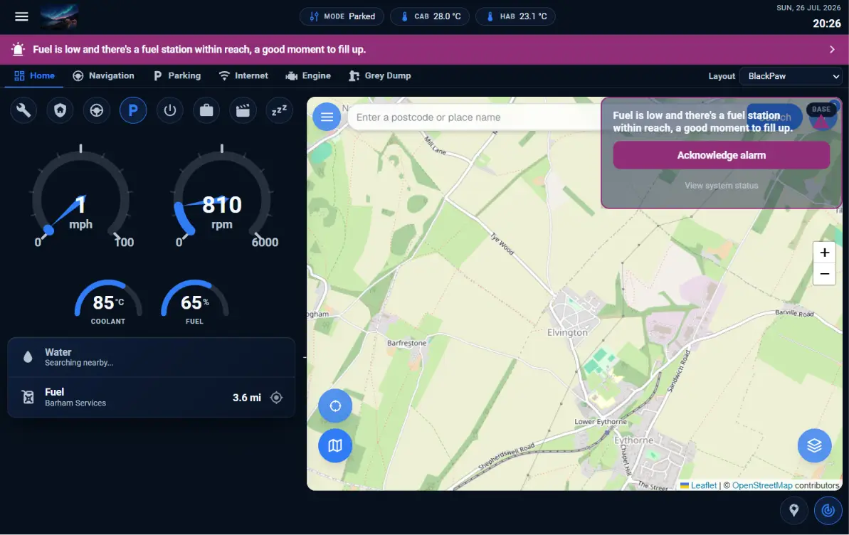
Sensa Radar replaces the endless “nearest X to me” searches that come with life on the road. We include Radar Pro as part of our navigation module inside our Nomad product. Nomad uses the GPS feature on your Teltonika router to power the navigation. However not everyone has a Teltonika router and we thought it may be useful as a standalone app for web and mobile, so we have released a standalone app too.

Radar

Free

Best for: Anyone living, travelling or working out of a vehicle

  • OpenStreetMap-based map and search
  • All categories, all hazard layers, all platforms
  • Web, iOS, Android and Home Assistant
  • Real-time fuel prices via the UK Gov Fuel Finder
  • Optional account for cross-device preference sync
  • Save your home and a few named locations
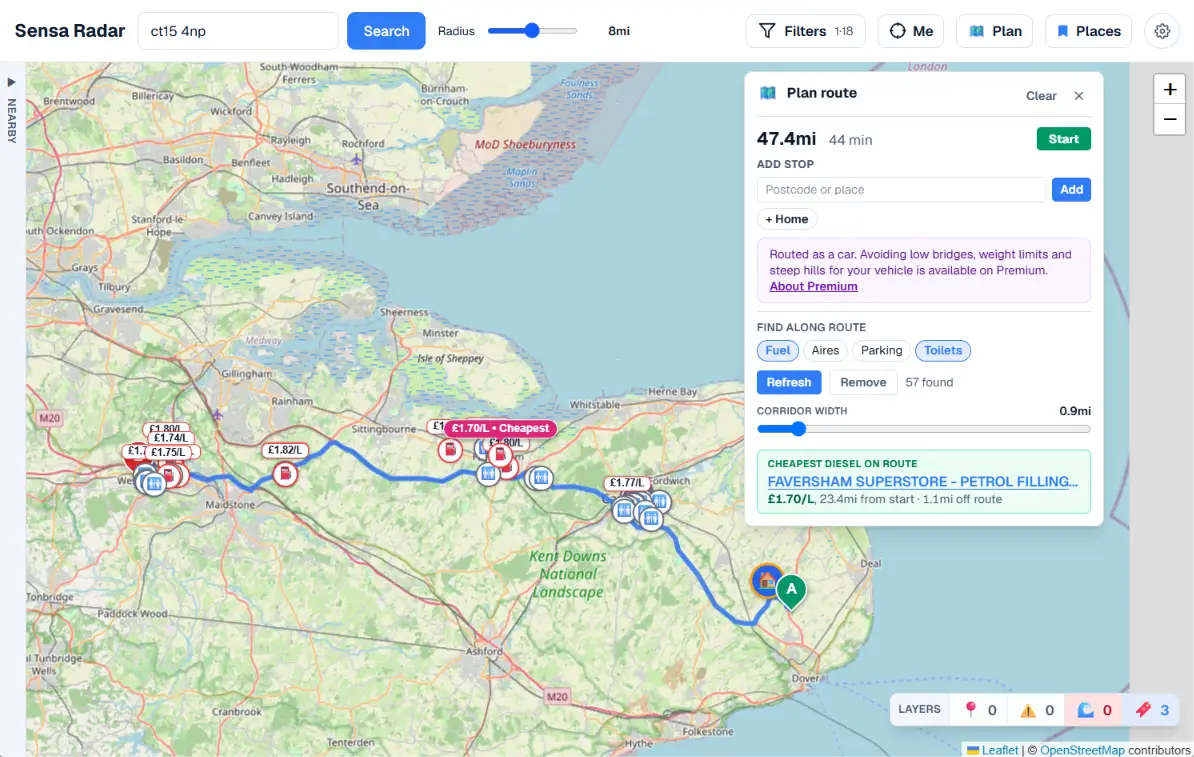
  • Route-based amenity search along a planned trip
Open Radar

Radar Premium

£3.95/month or £24.95/year

Best for: Full-timers or anyone who wants the richer map and live data

  • Google Maps tiles with satellite and street view
  • Google Places fills coverage gaps in OSM
  • Offline map tiles for poor-signal areas (mobile)
  • Vehicle-aware routing and upcoming-hazard warnings
  • More saved locations and named places
Register Interest

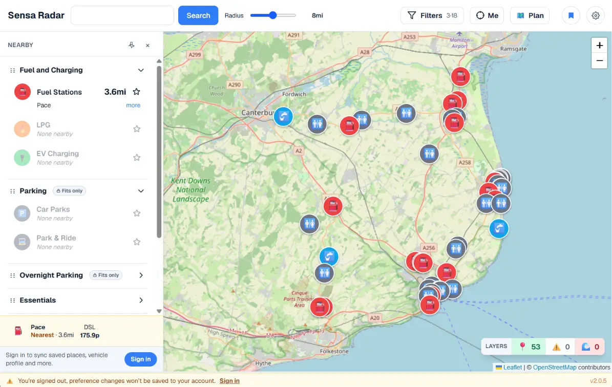
Pick the categories you care about, fuel, LPG, toilets, supermarkets, pubs, vets, campsites, aires, drinking water — and Radar shows them on a map and a list, sorted by distance, on whichever device is to hand.

Accounts and privacy

Radar can be used without a Sensa account. Without one, your preferences live in your browser. With one, they sync across web and mobile. Coordinates aren’t stored permanently, only your last-used location, in-session, for refresh.

What it does

  • Nearest view. One result per category, grouped and reorderable. Star the ones that matter to pin them to the top.
  • Drill down. Tap any category to see every result in your radius, filterable by data source.
  • Upcoming hazards. When you’re moving, Radar watches a cone ahead of you and warns you about restrictions in your path before you reach them.
  • Curated UK data. Toilets, fuel prices, EV chargers, ATMs, NHS pharmacies and dentists, MOT centres, libraries, bathing waters, parks and more come from authoritative open sources, not scraped from a single map provider.
  • Vehicle-aware hazards. Low bridges, weight limits, narrow lanes and active flood warnings rendered as their own map layers. Set your vehicle profile once; Radar only flags the hazards that actually block you. (Premium only)
  • Vehicle-aware routing. Plan a route that already avoids the hazards your van can’t clear — no separate truck-routing subscription required. (Premium only)

Full Capabilities

Find

  • Postcode or GPS search with adjustable radius (0.5 mi → 60 mi, fine at the low end)
  • 25+ amenity categories across 8 groups: Essentials, Fuel & Charging, Food & Drink, Health, Vehicle Services, Parking, Overnight Parking,
    Leisure
  • Filter results by category and by data source, with auto-refresh on every toggle
  • Nearest-first ranking across every source

Categories and what each shows

  • Essentials: toilets, launderettes, post offices, Amazon lockers, ATMs, pharmacies, drinking-water refills
  • Fuel & Charging: petrol/diesel stations with live prices, LPG/Autogas, EV charging with connector types
  • Food & Drink: supermarkets, restaurants, cafes, pubs with FSA hygiene ratings
  • Health: hospitals, dentists, vets
  • Vehicle Services: MOT stations, mechanics, tyre shops
  • Parking: car parks, Park & Ride, motorhome aires, laybys with fee, max stay, capacity, and vehicle-size limits where OSM has them
  • Leisure: campsites, gyms, swimming pools, parks, libraries, designated bathing waters with EA water quality

Data sources integrated

  • OpenStreetMap (Overpass), primary across every category
  • Google Places (Radar+ tier, gap-fill)
  • UK Gov Fuel Finder (mandatory reporting, 30-min price updates)
  • GB Toilet Map (15,800+ toilets, accessibility info)
  • Open Charge Map (EV network)
  • Revolution / Wash.ME (~1,264 self-service launderettes)
  • FillLPG.co.uk (~1,800 LPG stations, phone numbers extracted)
  • FSA Food Hygiene (every registered food business in UK)
  • Open Banking UK ATM APIs (13 banks, ~6,200 ATMs)
  • NHS ODS (pharmacies, dentists, hospitals)
  • DVSA Active MOT Stations (~22,500 centres, classes tested)
  • OS Open Greenspace (~165,000 parks and greenspaces, GB)
  • Library Data / ACE (~3,300 England libraries)
  • EA Bathing Water Quality (~450 English bathing waters)
  • EA Flood Monitoring (live warnings + polygons, 15-min refresh)
  • National Highways Network Model (Strategic Road Network restrictions)
  • Postcodes.io + Nominatim (geocoding)

Vehicle-aware

  • Save your vehicle profile (height, width, length, weight) once, reused everywhere
  • Map pins for parking and overnight stops flag whether you fit
  • Live hazard overlay: low bridges, weight/width/length restrictions — from OSM + National Highways
  • Route planner: honours your profile AND detours around Sensa Radar’s ingested hazards, not just OSM tags
  • Route view shows the hazards it avoided, so you understand the detour
  • Services-along-route: see fuel, food, toilets, etc scoped to your planned route

Live

  • Tracking with three states: Off → Tracking → Following. “Following” auto-recentres the map as you drive; drag the map to drop back to Tracking
  • Heading arrow from compass, GPS course, or motion-derived
  • Upcoming-hazards banner based on your heading
  • EA flood warnings rendered live on the map (amber / red / severe)